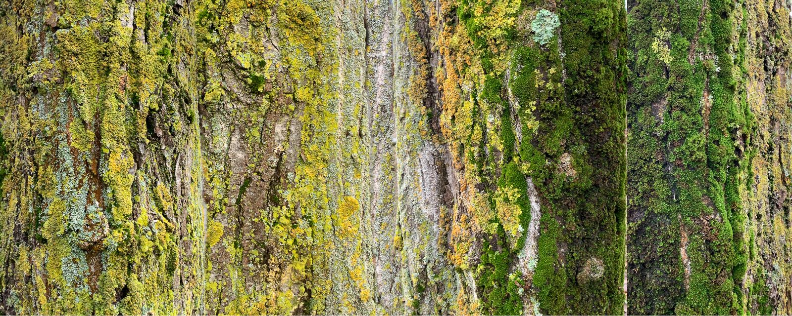
This picture alludes to a few areas related to my current preoccupation with remote sensing … the projection of curved surfaces is an Earth Observation (EO) basic. Imaging techniques originating in defence and military gradually filter their way down to citizens, such as ‘stitching’ ie the seamless creation of one image created from several being brought together such as for mapping purposes. Here I loosely manually ‘stitched’ the images. Another aspect of the remote sensing of vegetation is seasonal variation. During the Weatherscapes lab I considered that trees are augmented by lichen and moss patterns differently throughout the year. Alongside the value of trees themselves, I am curious as to how this ecosystem living on the tree adds to the tree’s value.